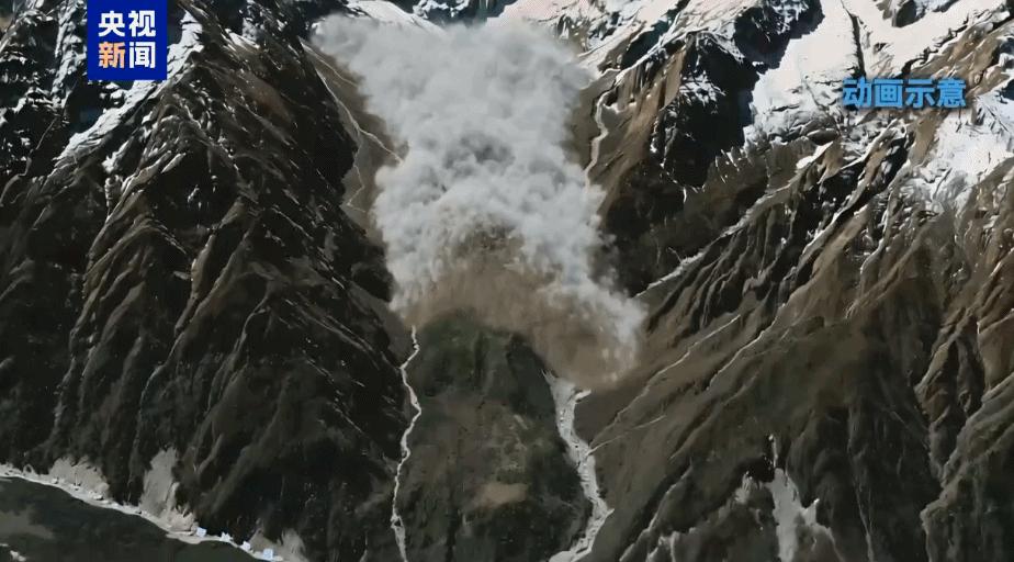
The latest remote sensing and field data from the Chinese Academy of Sciences highlights a stark reality regarding cryosphere hazards along the Himalayan border. When an ice-rock avalanche drops nearly 3,300 meters in elevation over a 22-kilometer travel distance in just seven minutes, the resulting dynamics push conventional risk models past their limits. Reaching an average velocity of 50 meters per second, or 180 kilometers per hour, the debris flow entered the Guobaxiaqu boundary river and swept into Gyirong Port at an altitude of 1,800 meters. The impact flattened 0.7 square kilometers and destroyed 27 buildings and supporting facilities, demonstrating how extreme kinetic energy transfers make alpine infrastructure highly vulnerable to sudden climate-driven events. Reports from outlets like People's Daily underscore how these cascading alpine disasters require an updated approach to cross-border risk management and civil engineering standards.
Analyzing the physics of this multi-stage hazard reveals why conventional disaster mitigations failed to prevent structural loss. The initial glacier collapse at 5,200 meters altitude rapidly scoured loose glacial deposits as it dropped to the 4,000-meter mark, compounding its mass before reaching the river system below. With peak speeds reaching 50 meters per second, the evacuation window across the 22-kilometer path was virtually zero. From an engineering and asset protection perspective, managing a high-density mudslide with such high momentum requires substantial capital investment in upstream retention structures and diversion channels. Standard structural reinforcement cannot withstand dynamic impact pressures of this scale without specialized debris-deflection barriers and automated early warning networks tied directly to real-time seismic and acoustic sensors.
To address these compounding climate risks along international transit hubs, regional authorities must implement a multi-layered prevention strategy focused on early detection and resilient infrastructure. Installing continuous satellite Synthetic Aperture Radar monitoring alongside ground-based slope stability sensors around high-risk glacial zones above 5,000 meters elevation can provide critical early detection of micro-surface displacements before major collapses occur. On the ground, cross-border logistics hubs like Gyirong Port need spatial zoning revisions that move critical operations, border facilities, and residential quarters outside high-velocity runout paths and flood channels. Combining real-time cryosphere monitoring networks, automated alarm systems capable of broadcasting alerts within seconds, and reinforced civil defense barriers will be vital to preserving human life and stabilizing cross-border supply chains against future extreme weather events.
News source: https://peoplesdaily.pdnews.cn/china/er/30053050068